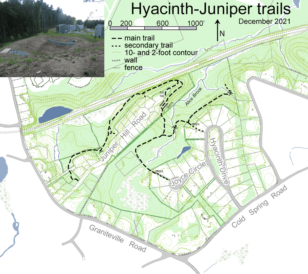
There are interesting trails in the Juniper Hill Road neighborhood and also in the Hyacinth Drive neighborhood. Those neighborhoods are pretty separated for cars and roads, but both have Conservation Land and trails which connect. One way to begin hiking is at the trail-head near the beginning of Juniper Hill Road. That trail goes through woodland and then provides a view of the railroad, where you may see a parked train. Continuing on the trail, you are on a large esker. The trail rises and curves to the right coming out of the woods at a vista of a large basin where you are walking along the top of one side of the basin. After passing over a footbridge, the trail turns left going downhill into woods. At that point you are in the Hyacinth Conservation Land. Continuing straight you will reach a T intersection, where a right turn will lead to Joyce Circle (a side street from Hyacinth) and a left turn will lead more directly to Hyacinth. The trail going left will take you to a footbridge over Alice Brook, named for Alice Day.
Decades ago, her family donated a large area to the Town, including the two islands where the Tom Paul Trail crosses Boutwell Brook. For many years the intersection of Cold Spring Road and Graniteville Road was called “Day’s Corner”.
When hiking, you could make a loop, going first out to Hyacinth Drive, then walking to the right on the road, then turning right onto Joyce Circle, and then going back into the Conservation Land from the trail-head at the end of Joyce Circle. That trail-head is not marked, but you can find it knowing that it’s just to the left of the driveway at 9 Joyce Circle.
Parking: ModerateTopographic Map
Click to zoom in or out
Difficulty
 Easy
EasyCautions
The trailheads on Hyacinth Drive and Joyce Circle are not apparent.