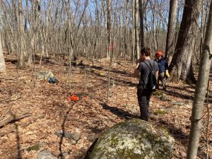
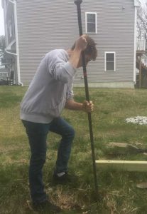
This spring the Westford Conservation Trust was faced with two large projects to complete. The first project was clearing and re-opening a trail which follows both sides of the scenic Vine Brook from Powers Road to Lyberty Road. The other project was creating a trail connecting our Hildreth Meadow property to Burns Hill, providing an enjoyable hike for the hardiest of individuals.
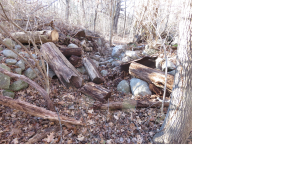
The Lyberty Trail was unused for several years due to construction around Powers Road. Covid concerns focused our trail stewards’ attention on maintaining Westford’s existing seventy five miles of trails. There were over thirty-five fallen trees blocking the Lyberty Trail and the Burns Hill Link, two damaged footbridges across Vine Brook from heavy spring rainstorms, and trails hidden by several years of leaves. It looked like it might be another year before these trails would be completed. We were very fortunate that local resident Tom Provost cleared a path through a particularly large stone wall (the photo shows the wall section) to allow the manual trail construction of the Burns Hill Link.
On April 4, 2022, the Westford Trust received an email regarding sponsorship of a Capstone event for three Westford Academy seniors.
We scheduled a Zoom meeting to introduce the three students to our supervising trail stewards and present our projects. The Capstone event was scheduled for five weeks, which included one week for school vacation.
We started on Monday, April 11th, working two projects simultaneously. One project was the Lyberty Trail with Academy seniors, Jacob Power and Jordan Kohen working with supervisors Ron Gemma and Dave Ebitson.
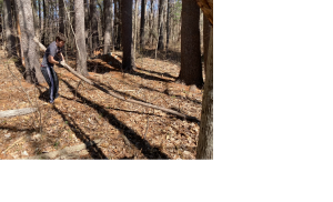
Academy senior Michael Greene worked on the Burns Hill Link with supervisors Gerry DiBello and Rich Strazdas, All supervisors were board members of the Westford Conservation Trust.
The Burns Hill Link Trail begins at Hildreth Meadows, a small pasture the Trust restored in 2018. It follows a Collins property trail easement granted in 2019 and crosses over Vine Brook and joins the Burns Hill Loop Trail.
There were many obstacles from Hildreth Street to Burns Hill. Michael Greene and supervisors Gerry DiBello and Rich Strazdas spent the first few days clearing rocks and stumps until they reached a yearly flooded section. Michael quickly learned how to use a laser instrument to measure the length of the flooded section of the trail easement for a required boardwalk.
Michael and the team moved years of accumulated small dead branches and rocks deposited by the glaciers retreating north thousands of years ago, and rocks left over from stone walls built by the early settlers of Westford when clearing their fields. (The photo shows the rocks along the Burns Hill Trail extension).
Out of the mud and past the rocks, they moved onto a trail where the wind had blown down 19 trees and tree branches over the years. The chainsaw crew came in and cut them up into manageable lengths for removal.
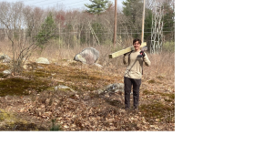
After a week the trail was cleared of trees and branches and was raked clean of debris to allow safe passage. The view of the adjacent pasture and the wooded area is an ideal site for observing wildlife.
Approaching the third week, Michael and the team reached the Burns Hill Trail, still clearing trees and branches. Finally they reached the end at the Burns Hill yellow loop trail. The Burns Hill Link was now ready for signage and blazing to assure no one would lose their bearings on a new trail walking from either direction. Blue paint was selected to designate a spur trail from Burns Hill to Hildreth Meadows. (The photo shows one of many trees blocking a trail).
Michael skillfully applied trail blazes in accordance with the Appalachian Mountain Club guidelines. Three trail posts were installed to indicate key entry points on the trail. Michael soon realized the challenges of farming years ago in Westford by the number of rocks that needed to be removed when digging a hole for a trail post. It was a skill he would use several more times in the following weeks. With the blazing completed, the Burns Hill Link will be utilized once the boardwalks are installed across the muddy sections of the trail.
The Lyberty Trail crosses Vine Brook and extends from Sugar Maple Lane off Powers Road to the end of Lyberty Road and back to Powers Road on the other side of the stream. With Jacob Power, Jordan Kohen, supervisor Ron Gemma, and later Michael Greene, we started the project at the trailhead on Sugar Maple Lane. There are four designated parking spots for trail hikers entering Sugar Maple Lane from Powers Road. The trailhead is on the right off the sidewalk.
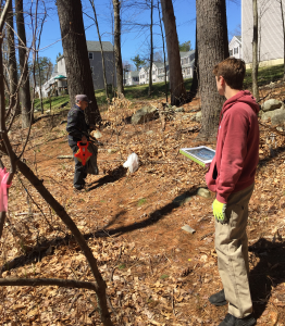
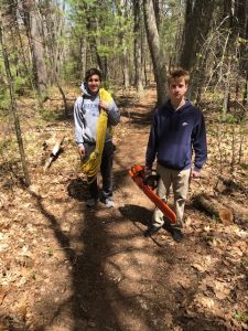
The Lyberty Trail meanders behind the Sugar Maple Condominiums on conservation property. Ron Gemma, Jacob Power and Jordan Kohen worked on the trailhead, and carefully groomed the trail along the conservation land which passed the Sugar Maple Lane complex. (The photo shows Ron and Jacob confirming trail placement). A large amount of Multiflora Rose was pulled from this area of the trail and placed in a large contractor’s bag for disposal. Jordan and Jacob used loppers to create a four-foot-wide by eight-foot-high doorway along the path to provide a clear walkway.
After several years of neglect due to construction and the pandemic, the wooded area and conservation land had suffered from litter blown in from Powers Road and Rte. 110. Jacob and Jordan cleaned the trail, wetlands and wooded area, collecting several contractors’ bags of litter, Then we started walking east to assess the condition of the trail on either side of Vine Brook.
The trail on the north side of the stream runs along an esker which rises as you walk east. In this area there is an abundance of wildlife such as deer, beavers, numerous species of birds and even a few clusters of garden snakes possibly looking for one of the many frogs we spotted on the edge of Vine Brook.
We found seventeen trees and large branches which had fallen and blocked the Lyberty Trail. With the help of Jacob and Jordan, the trees were cut and moved off the trail using a logging canter for the large logs.
Next, the trail was cleared of leaves, ensuring safe passage as we walked along the top of the esker on the north side of Vine Brook.
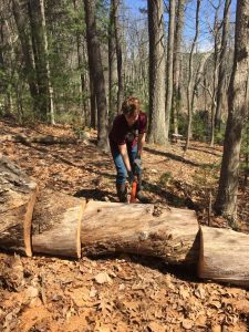
After the trail was cleared, it was marked with a yellow blaze following the guidelines of the Appalachian Mountain Club. We started at Powers Road and headed east towards Lyberty Road. (the photo shows Jake rolling sections of a cut tree with a logging canter).
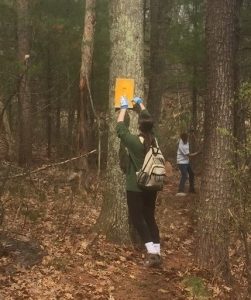
Jordan and Jacob blazed the trail using a wire brush to clear dust and moss from the bark, and a blazing template of the standard two inch by six inch blaze as they headed east. Progress was quick as they marked the trail, providing assurance to novice hikers that they were still on the trail.
The April rainstorms provided a much needed day of rest for our team but caused a few log jams at the footbridge crossing. As we approached the Lyberty Way Industrial Park, we came to the first of two footbridges crossing Vine Brook at the east end.
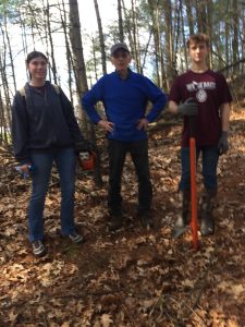
At this time Michael Greene had finished the Burns Hill Link and joined us at the eastern end of Lyberty Trail. He was a welcomed addition. We began to clear the trail, accessing two footbridges and the trail west on the opposite side of the stream. The first footbridge was damaged, and the second footbridge was intact and usable. (The photo shows Jordan blazing a tree).
With our team of three seniors and two supervisors we started confirming the location of the trails and creating the trail corridor. Once we cleared the trail the team picked up another two large bags of litter blown into the wooded area and trails. Our Capstone students blazed the trails, providing clarity to the location of the two footbridges. The team then headed west on the other side of Vine Brook clearing several trees and one precarious leaner at the far end of the trail. They finished blazing the trail to the western most terminus.
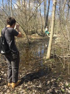
The team found that beavers had dammed a small stream flowing into Vine Brook resulting in a large backup of water into woodlands on the south side of Vine Brook.
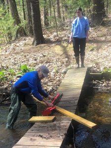
Unfortunately, the footbridge on the far west end had been damaged and washed away by the abundance of rainfall over the last several years. Perhaps this could be a new project? (The photo shows Ron and Jordan repairing a footbridge}.
With Ron Gemma providing repairs to a damaged footbridge, the Lyberty Trail project was finished.
With approximately a week or so left of our Capstone event, our student volunteers were eager to contribute their additional time in new areas. A footbridge was in need of repair on the Richard Emmet Conservation Land crossing at the Nonset Stream. Several planks were rotted and damaged and a large tree branch had floated underneath the footbridge, further jeopardizing the structure. With new planks, drills, deck screws, a chain saw, rope and a farmer’s jack, the team met at the trail entrance on Texas Road for repair work and carried all supplies and tools to the worksite down the Green Trail at Texas Road and then right onto the Blue Trail to the footbridge.
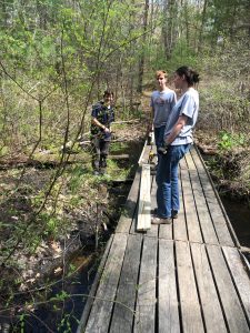
All rotted and damaged planks were removed. The log that was jammed under the footbridge was cut, tied to a rope, and Michael pulled it free. We replaced all damaged planks and tightened all loose boards and replaced missing and damaged side boards. Repairs were complete! (The photo shows Michael, Jordan, and Jacob repairing a footbridge).
But what was next? At the other end of town, four trail posts needed installation by our very experienced team. We met at the far end of Greystone to install four trail posts and provide continuity as trails crossed from one side of the road to the other.
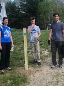
It was amazing how efficiently the students worked together as a team. With one more day left of their Capstone project, we received an email and we knew what the last day’s project was a large tree that had fallen down at Grassy Pond. We needed a team who worked well together to move the logs and who were experienced with a logging canter The next morning our Capstone students showed up on time with their work gloves and ready to work. (The photo shows a trail post installed at Greystone Trail).
We looked at the trail map, noted the tree location and off we went. Three trees in one group had fallen across the trail. We definitely had the right team in the right place. While the supervisor cut the trees up into manageable lengths using all safety precautions, the students removed all pieces off the trail and raked it clean.
The Trust recognizes the hard work and dedication of our Capstone Project senior along with our Trust mentors to complete these multiple projects in support of the community’s use of Westford’s Trails!
* A high school Capstone project is a way for students to demonstrate the culmination of skills and knowledge gained through their academic career by completing a long-term, multi-faceted project. It’s typically performed at the end of a student’s high school career.
