These trails encompass a remarkably wild area in the midst of one of the most developed parts of Westford. The industry along Lyberty Way was built in 1982, and much of the commercial development along Route 110 was from that time period. The views vary from woods and eskers, to wide floodplains, to narrow brook channels.
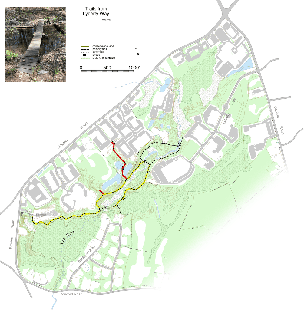
Loop hikes are currently not possible. There used to be four bridges across Vine Brook. In 2013, one bridge was washed away. Nearby is a newer, sturdier bridge. Also, the westernmost bridge, set low over the brook, was submerged before being washed away around 2019. The trails north of the northernmost bridge have been reclaimed by nature. They may be reestablished with a concerted effort.
There are many side trails to local businesses, indicating frequent use of the main trails on both sides of Vine Brook. Please be respectful of these neighbors so the entire trail system may continue to be used by employees and visitors.
The western trailhead was established in 2019 at the Sugar Maple Lane development off Powers Road. Park in the four spots close to Powers Road, and find the trailhead 100 feet in on the right. This development resulted in the Trust acquiring the adjacent parcel to the south on Powers Road. Abutting the Trust’s Heald parcel (where “Vine Brook” appears on the map), it ensures that this wetland is protected from industrial harm.
Your only dry option is to keep to the left of Vine Brook. It is worth a look at the site of the phantom bridge.The central section, on the right bank of the brook, travels at the base and along the ridge of an esker, one of many in Westford. Eskers are the remains of streams that ran beneath glaciers. When the ice finally retreated, sand and gravel was left as winding ridges, usually 10-30 feet tall. The high point of this esker is indeed 30 feet above Vine Brook. Due to their nature, any rocks you find are likely to be rounded, even on the ridge.
The middle bridge appears precarious but is quite safe; it is pictured on the map. Downstream on the left bank, the trail dead ends. You can wave to your earlier self from this end of the phantom bridge. Beyond the middle bridge, unblazed trails continue upstream to the sturdiest bridge, made even stronger by being tied to both shores.
From near the end of Lyberty Way, make your way downstream on either side of the brook, noting that the left bank eventually dead ends.
Shortly before this edition was published, two Westford Academy students, Jakob Power and Jordan Kohen, improved the trail bed and blazing of these trails as a Capstone Project.
Location
From Carlisle Road, park at the bulge in Lyberty Way. From there, find the faint trailhead in the middle of the north (right) bulge.From Powers Road, park in the trailhead lot near the start of Sugar Maple Lane.
Parking: Ample
Topographic Map
Click to zoom in or out
Difficulty
 Easy
EasyActivities
- Hiking