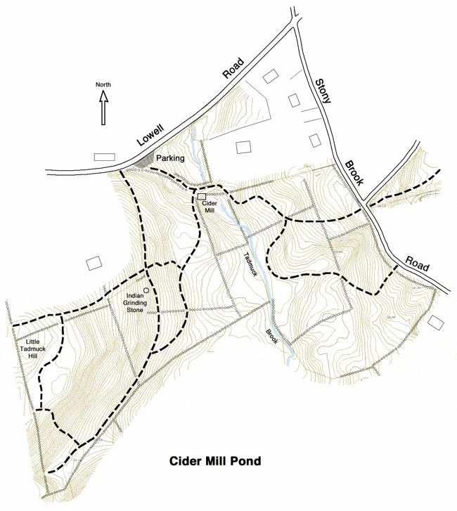
Cider Mill Pond is in the midst of 39 acres of conservation land, an attractive woodland covered mainly by large white pines. A cider mill was operated here by Dan Sheehan at the turn of the century. The cider mill building was destroyed by fire in 1905, but the stone foundation of well fitted large granite blocks still exists. The most direct trail access is from the parking area on Lowell Road. Another trail leads in from Stony Brook Road, and other woodland trails connect into this area.
The cider mill was powered by water, and therefore a dam was constructed in Tadmuck Brook, forming the mill pond. Most of the granite structure of the dam can still be seen, but the dam itself was damaged in the early 2000s. There is also a kiosk next to the stone foundation with historical photo and info.
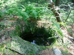
Downstream of the Cider Mill Pond, on the west side of Tadmuck Brook, is an old apple orchard. On the other side, uphill from the old mill is a striking deep hole in the bedrock. This has been a topic of discussion and debate for years. It’s called the “Indian Grinding Mill” by many, thinking that it was used by the native people in this area, who probably camped regularly on the flat ground downstream where Tadmuck Brook reaches Stony Brook. Others have speculated that this hole was created by flowing water at the time when the glaciers melted. We know that the ice was about a mile deep over Westford, and that when it melted, it tended to form concentrated streams of water containing sand and gravel. Have a look and maybe you will solve this mystery.
See also The Long Trail for connections to Buckboard Drive and Mystery Spring.
In the mid-2010s, a trail was cleared from Providence Road to the Adams property. This is the Devil’s Walking Stick (Aralia Spinosa) Trail, named for the short, spiked trees found near the stream east of Boxwood Road. In 2019, the town purchased the Adams property, realizing our hope to connect this trail to the trails on Little Tadmuck Hill.
Location
The most direct trail access is from the parking area on Lowell Road. Another trail leads in from Stony Brook Road, and other woodland trails connect into this area.Parking: Ample
Trail Map
Click to zoom in or out
Topographic Map
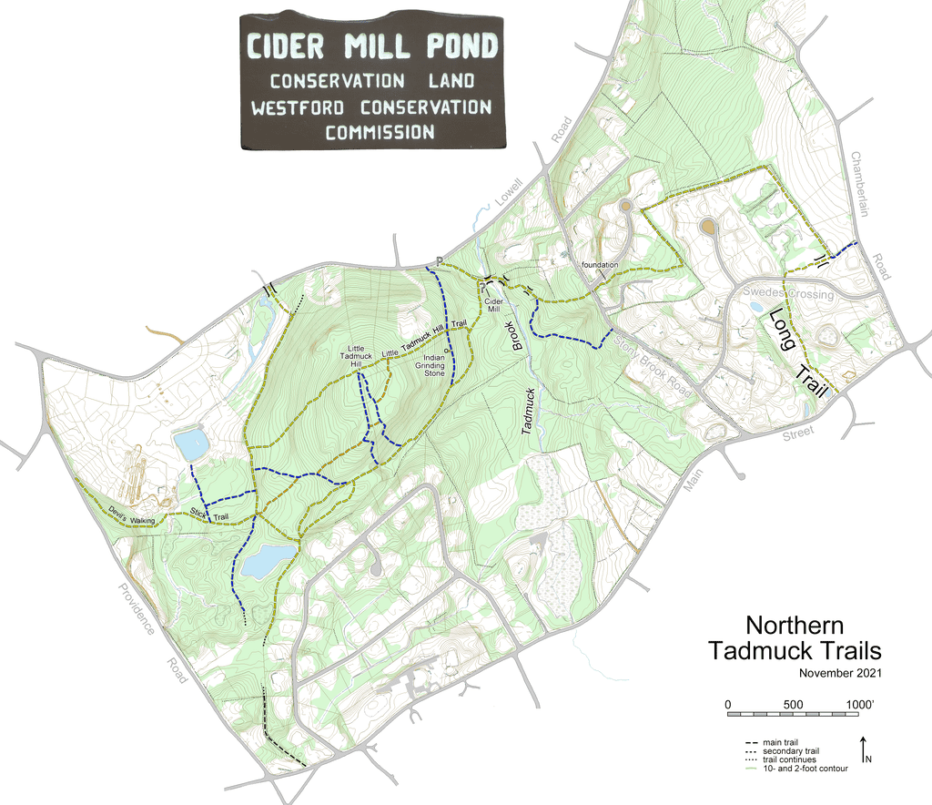
Click to zoom in or out
Difficulty
 Easy
Easy